Drawing the Impossible: The Cassini Map of France
How four generations of astronomers tried to measure an entire country—and almost lost it to the king, the people, and the mountains.
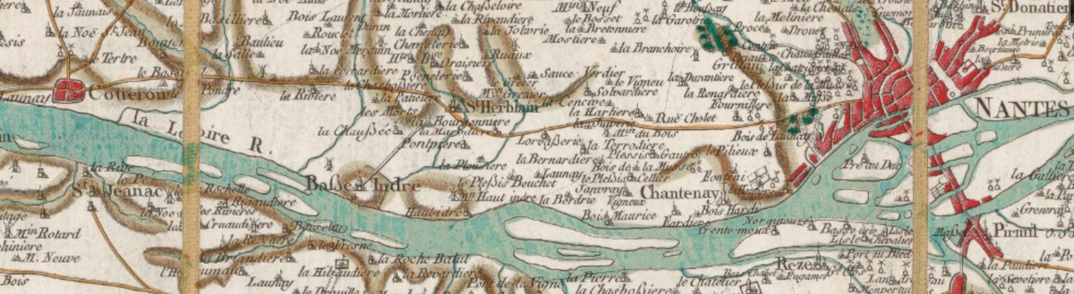
The first real map of France took four generations, sixty years, and thousands of miles on foot. No GPS, no railways, no common language—just telescopes, compasses, and stubbornness. By the time they finished, France itself had changed governments three times.
In the mid-18th century, before roads, railways, or even a common language, a family of astronomers set out to map all of France—from the edges of Brittany to the peaks of the Alps—armed with nothing but telescopes, compasses, and patience. The mappers needed to be swimmers, mountain climbers, scientists and diplomats to create the first map of any country in the world.
TL;DR:
The Carte de Cassini was France’s first complete national map, begun in 1747 under Louis XV, continued through the French Revolution, and finally completed around 1815 under Napoleon’s Empire. Four generations of the Cassini family spent sixty years charting more than 200,000 square miles, enduring regime changes from monarchy to republic to empire—and yet, not one ruler was satisfied with the results
Across four generations—and under at least three entirely different governments—not a single ruler was satisfied with the results.
The Carte de Cassini took sixty years and tens of thousands of miles of travel to complete. It became the first detailed map of France—and quite possibly the first truly scientific map of any nation in the world.
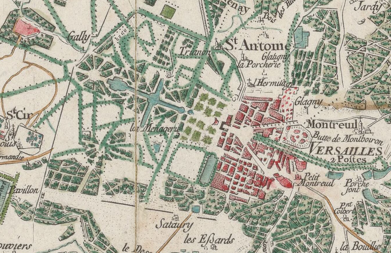
[ed. note: You can skip straight to the map—it’s stunningly detailed. It’s also on Gallica, where it’s easier to zoom in and find specific places.]
France terra incognita
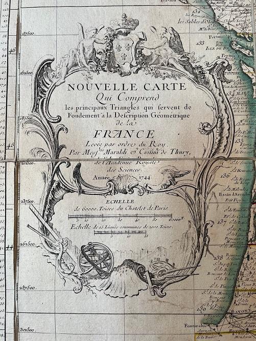
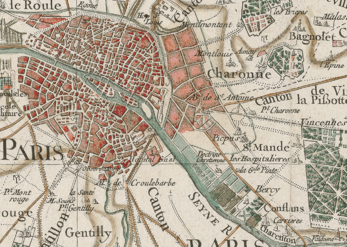
The Carte de Cassini was a monumental mapping project undertaken by four generations of the Cassini family: with Cassini I, the astronomer, developing triangulation as a technique, followed by Cassini II, Cassini III and Cassini IV, who complete the map. The bulk of the research was under Jacques Dominique Cassini (Cassini III) and Jean-Dominique Cassini (Cassini IV) from 1756 to 1815. It culminated in the first detailed map of France and, quite possibly, of any country in the world. There have been few journals of these travels, but researchers likely covered tens of thousands of miles checking and rechecking as they mapped France’s 200,000 square miles of territory.
At that time, getting from Paris to the farthest reaches of France involved travel by foot or by wagon that more difficult and time-consuming than to sail from France to South America.
It wasn’t about one genius but about people pooling their information. Before large national projects, most surveying and astronomical work was done in isolation, often unpublished. There was more knowledge around than ever appeared on maps.
The Cassini map changed that, launching a Western push to gather and standardize this scattered data for modern mapmaking.
![r/MapPorn - The first triangulated map of a nation, Cassini's 1745 map of France, compared to previous maps [1227x770]](https://storage.ghost.io/c/57/61/5761c3c9-302e-49ad-aa94-120ab6ecf092/content/images/2026/08/3bc1d4e4-e227-4a4b-8383-4f3991baaf86_640x401-jpeg.jpg)
At the time, most people in France barely traveled beyond their own valleys. The idea of crossing the country was almost unimaginable. Roads were muddy and broken, carriages slow and expensive, and rivers often the only reliable routes.
It wouldn’t be until a century later—when the railways connected Paris to the provinces in the 1850s—that ordinary people could move easily between regions.
For the Cassinis’ surveyors, every step across France was an expedition, progress measured not in miles, but in obstacles.
The Map That Shrunk France
Cassini’s Grand Survey
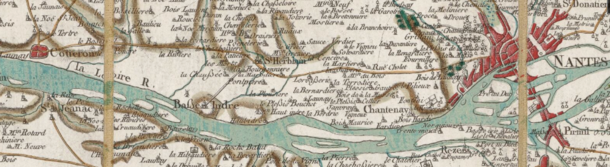
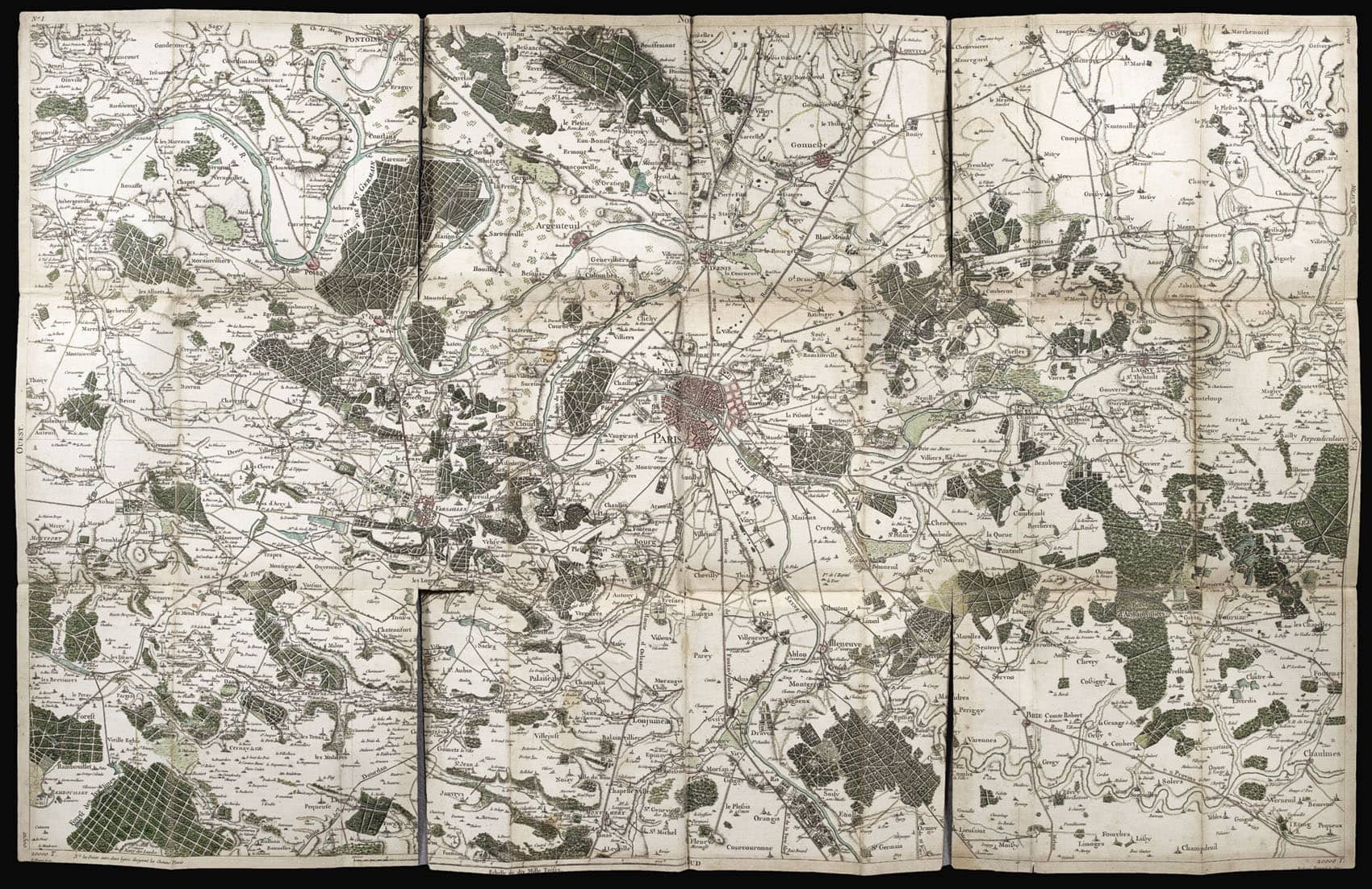
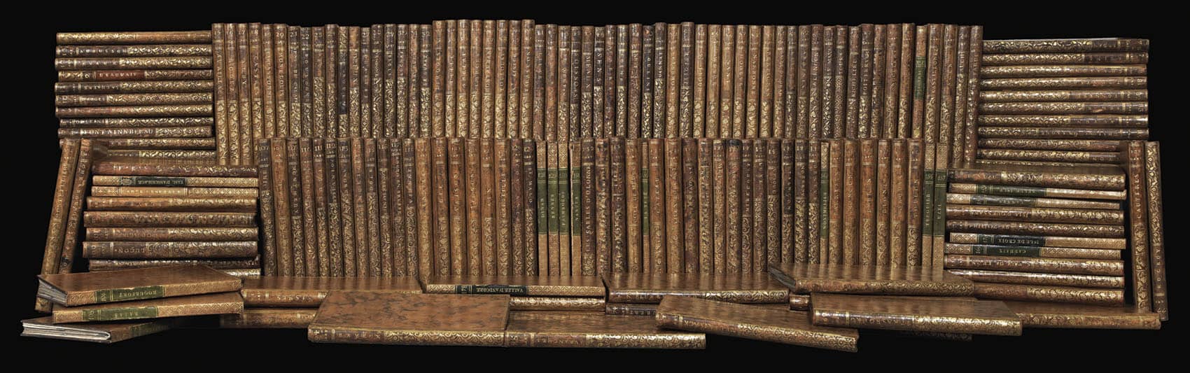
When it was finally published, the Carte de Cassini stretched across 182 engraved sheets, each roughly 24 by 36 inches. When laid out together, it covered more than a thousand square feet—bigger than our last apartment - by a lot. It was the first complete, detailed map of France, and it transformed geography, science, and how people imagined their own country.
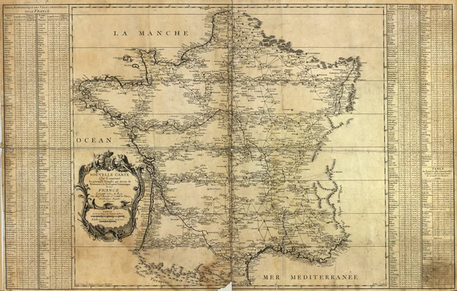
Before this, the most accurate maps had been of coastlines, not land. Mariners had precise navigational tools; inland, maps were guesswork—decorative fantasies that exaggerated distances and inflated territories to flatter kings.
So when Cassini III presented his measured version to Louis XV in 1756, the reaction was not what he hoped for.
The map showed a smaller France than the one of the king’s imagination.
“You have cost me more territory than all my enemies!” Louis is said to have shouted.
The king withdrew funding, leaving Cassini to seek private investors. He managed to raise what would be millions today, but when the work was complete, Napoleon’s army confiscated the copper plates in the name of national security. The Cassinis never made a profit.
Cassini III first estimated the project would take eighteen years and a fraction of the cost it ultimately demanded.
It took generations—hundreds of surveyors, cartographers, and assistants crossing mountains, rivers, and forests. They had to be part scientist, part mountaineer, part swimmer, and relentlessly stubborn.
France didn’t speak French
…At least not everywhere.
The survey teams weren’t always welcome.
Wandering scientists with their tripods and tools seemed suspicious—or even supernatural. In some places they were mistaken for tax collectors; in others, for sorcerers. Crews were chased out of towns, jailed, or threatened by locals.
Seasoned surveyors learned to communicate without words, developing a kind of sign language to get by in unfamiliar languages.
In the mid-18th century, “French” was not France’s language. It was spoken around Paris; but the rest of the country was a patchwork of Occitan, Breton, Basque, Catalan, Franco-Provençal, Corsican, Flemish, and countless dialects of Oïl.
In some valleys, the next village over might as well have been another country.
Mapped Precisely, But Not Always Accurately
In the end, the Carte de Cassini wasn’t exactly reliable. It’s full of phantom towns, invented roads, and generous exaggerations of noble estates—especially ones belonging to families who’d been good to the surveyors.
Hospitality could buy you a little extra land.
Some of these same nobles renamed hills and streams after themselves, getting their family names were etched into the national landscape—even if locals never knew them that way.
And then there were the roads.
The map shows wide routes slicing through the Alps that in reality, not even a goat could manage. Long after the map’s completion, Napoleon’s soldiers were still getting lost trying to follow them. Training exercises regularly devolved into orientation drills. Unless one of the soldiers happened to have been born in the region, some groups lost nearly a week just trying to figure out where they were.
On a trip, Josephine, Napoleon’s wife, was forced to dismantle her carriage and carry it piece by piece down a hill that the Cassini Map described as a simple straight road. The road was so steep that members of her party had tumbled down ahead of her.
It wasn’t corrected until long after Napoleon’s death—perhaps because he preferred it that way. A few misplaced roads, he thought, might be useful if your enemies were just as lost as you were.
The Limits of Knowing
The Cassini Map was a triumph—and a warning.
It proved that people could measure the Earth with extraordinary precision, but also that didn’t guarantee truth.
Each line, each angle, was a claim to understanding a country that was still arguing about itself. And like the Turgot Map before it, the Carte de Cassini reminds us that every attempt to capture the world—on paper, in words, in data—is a kind of fiction.
Still, there’s beauty in the effort.
Sixty years, four Cassinis, and one very unhappy king. What surprised you most about how France first mapped itself?
Further reading
 Keith Christiansen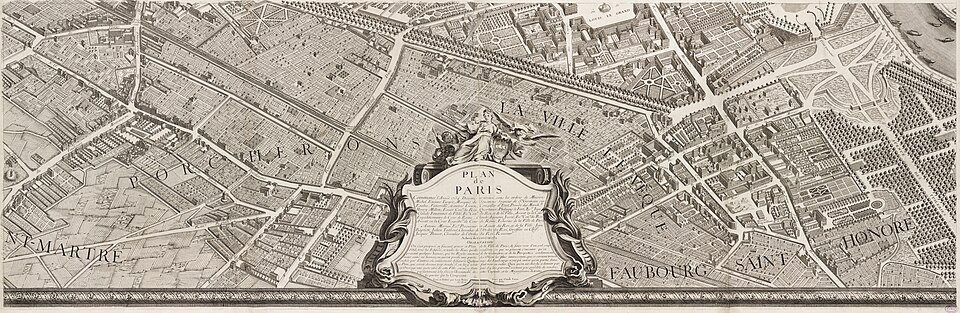
 Keith Christiansen