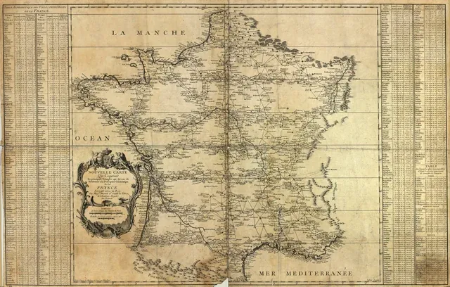
The first French Map: the Carte de Cassini
the first full map of France was also full of problems
France: a terra incognita
The Carte de Cassini was a monumental mapping project undertaken by four generations of the Cassini family: with Cassini I, the astronomer, developing triangulation as a technique, followed by Cassini II, Cassini III and Cassini IV, who complete the map. The bulk of the research was under Jacques Dominique Cassini (Cassini III) and Jean-Dominique Cassini (Cassini IV) from 1756 to 1815. It culminated in the first detailed map of France and, quite possibly, of any country in the world. There have been few journals of these travels, but researchers likely covered tens of thousands of miles checking and rechecking as they mapped France’s 200,000 square miles of territory.
At that time, getting from Paris to the farthest reaches of France involved travel by foot or by wagon that more difficult and time-consuming than to sail from France to South America. Walking it was generally preferred.

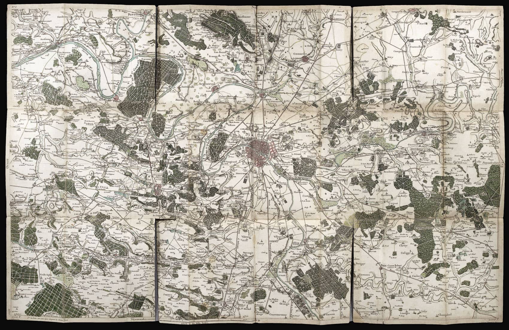
Cassini’s Map of France
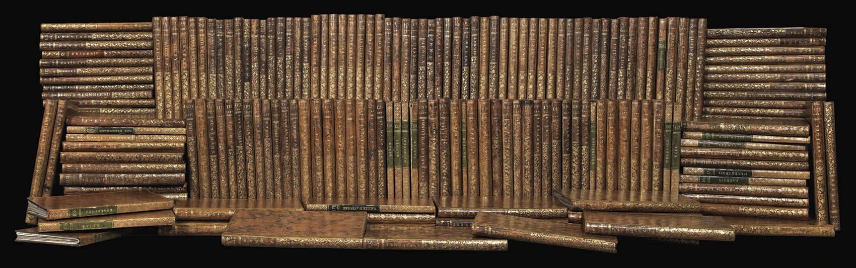
When published, the map was composed of 182 sheets (each 24’ x 36’, roughly) folded into books that were over 1,000 square feet when laid out flat. It was the first of its kind and transformed geography and cartography.
The most accurate maps were done by sea before this, where navigational tools enabled precision. Inland, most of the country was just guesswork, often exaggerating the size of territories to make the kingdom seem larger, at least to the king.
King Louis XV was not pleased with the results of Cassini III’s survey in 1756 and withdrew funding.
"You have cost me more territory than all my enemies!" he is reported to have told Cassini.
Louis XV's reaction to the map's presentation forced the Cassini’s to find private funding based on profits for published maps. While Cassini III raised what would be millions in today’s money, but by the time it was done, Napoleon’s military confiscated all of the plates in the name of national security, and it never made a profit.
Cassini III first estimated it would require 18 years to draw the map and cost less than a tenth of what it finnaly did. The project involving hundreds of surveyors, cartographers, and assistants navigating the country's diverse and rugged terrain. Cartographers often had to be skilled swimmers, trekkers, and mountain climbers as well as map-makers.
The survey team was not always welcomed.
Small villages and towns treated foreign scientists as wizards or worse, as tax collectors. There are stories of surveyors and their teams being chased, imprisoned, or threatened with worse as traveled far-flung parts of the country.
The most successful surveyors became good at sign language, of a type. The languages of France were not all French, a language only spoken near the capital of Paris, but included Occitan, Oïl languages, Breton, Catalan, Basque, Franco-Provençal, Corsican, Germanic dialects, and Flemish. There were endless local variations. Sometimes, people in one valley spoke such a different dialect that those in the next valley could barely understand them, never mind some surveyor from the other side of the country.
Mapped precisely, but not always accurately
Despite aiming for accuracy, the Carte de Cassini includes many "phantom" towns, roads, land formations that don’t exist and exaggerations of the sizes of teritorries of nobles who had been especially hospitable to the map-makers. Many of these same nobles would describe the lands around them with names they made up, ensuring their family names would be marked on the landscape, even if the locals called it something else entirely.
There were wide roads drawn through the alps that not even the goats could traverse. Even once the Cassini Map was finished, Napoleon and others suffered major setbacks as regular training exercises devolved into orientation efforts soldiers got lost as the army tried to simply figure out the landscape. Unless the soldiers were actually from that part of the country, entire battalions could lose weeks this way.
Josephine, Napoleon’s wife, was once forced out of her carriage as it had to be carried in pieces down a hill that was marked as a simple straight road on the map. Members of her party had tumbled down the hillside ahead of her and the map was not corrected until well after Napoleon’s death. He thought that keeping the inaccuracies could be an advantage against his enemies.